Friday, August 31, 2012

Day 28 - Dawson Creek

Boy what a cold night it was last night!  We were dragging our spare blankets out to keep warm in the middle of the night.  This morning there was frost on the ground.
 
The Rotary Club at Dawson Creek cooked us breakfast of sausages, scrambled eggs and pancakes with butter and maple syrup in the hall at our campground. It was very much appreciated by the convoy members before most of them set off on their travels to return to their homes.
We will spend a couple of extra days here in Dawson Creek and take time out to rest before we hit the road again and make our way back to Vancouver where we will organise for George to be shipped home. It is a public holiday in both Canada and America this coming Monday and the children return to school on Wednesday after their summer break so it is a good time to be off the road.
For us both this has been a trip of a lifetime and one we have thoroughly enjoyed. It is now time to take it easy and explore a bit more of Canada before we return home.
 
We will still update this blog when and where we can so you all know what it is like to be RETIRED!!!

Day 27 - Dawson Creek

Our day started with a breakfast of sausages, scrambled eggs and pancakes with maple syrup and butter at the Royal Canadian Legion Branch in Fort St John. For 77 years this branch has been a social gathering place for veterans, active members of the Canadian Forces and the RCMP. Our vehicles were on display next to the building and down the street.
Fort St John was a bigger town than what we first thought and the streets extended much further back than was visible from the main road. Obviously the gas and oil industry is a major player in the employment of the people in this town.
We travelled once again through Taylor and over the magnificent Peace River Bridge to Dawson Creek. A delicious lunch of soup, sandwiches and desert was provided by the community of Dawson Creek. Jim was interviewed by a reporter from the local TV station who wanted to speak to the Aussies on the trip. He was also interviewed by the female reporter who had interviewed him at the beginning of the trip to ask what he thought of the trip.
That night was our final farewell banquet dinner at the George Dawson Inn for all of the convoy members. It was a great social event with delicious food, good company and lots of stories to share. I was fortunate to win a jumper in the raffle!   We had 5 convoy members in their teens and 3 in their 80's and they received a loud round of applause from everyone. There were lots of photos taken, books, flags and convoy signs autographed, emails and addresses exchanged and a great feeling of comraderie amongst everyone.
This has been a very well organised convoy and our thanks go out to those who have put in hours and hours of their own time to make sure this convoy was the success it was. We have had such a good time and thoroughly enjoyed the company of our fellow convoy members along the way. The scenery has been superb and the friendliness of the local townspeople in welcoming us into their communities has been overwhelming. When you drive along this highway you are constantly reminded of the achievements of the men who built it in 1942 in such a short space of time, under extreme weather conditions and with the old vehicles that some of us are driving today. We are certainly in awe of their achievements.

Day 26 - Fort St John

Our journey today was from Fort Nelson to Fort St John which was a long day of 240 miles.
There were several sections of roadworks and very steep grades - 2nd gear work. We were unable to use the right hand fuel tank so had to borrow a jerry can of fuel from one of our convoy members. A couple of the places that we stopped at were selling fuel on our way up but had signs on their bowsers that they had no fuel so we were unable to top up our tank.
At one of the stops we met a young man called Adam from Melbourne who has been working on the gas fields as a pipe fitter for the past 6 years. He is excited about visiting home next month as it is the first time he has been back to Australia since moving to Canada.
The traffic was getting busier with gas, fuel and log trucks, pickups and tourists and it was pretty stressful driving. Many cases of broken road rules and close calls.
We arrived in Fort St John mid afternoon and camped in the sports ground next to the Rotary RV Park.  One of the first grassed areas that we have seen in a long while.  Jim went across to the local pub but was told that they do not have any non-alcoholic drinks for sale to take away!! There was a cold wind blowing so we went to bed early.

Day 25 - Fort Nelson

Our destination today was Fort Nelson. It was a day of steep inclines and declines through the Rocky Mountains and around the beautiful Muncho Lake. We saw a deer next to the road but don't think that we were quick enough to capture it by the camera.
It started to rain heavily in the afternoon and our van stopped due to a blocked fuel filter and lines. We appear to have contaminated fuel in one tank so have to use the fuel in the second tank and a jerry can. This was the first day that we have had a problem with the vehicle and spent the rest of the day with the maintenance convoy. Fortunately Jim managed to fix the problem by replacing the filter and using the other fuel tank and we had no further problems. The rule is that when one vehicle has a problem and stops the vehicle travelling directly behind it stops also and then you wait for the maintenance vehicle. We spent the rest of the day in "the naught boys' school" which is what we have nicknamed the maintenance convoy. We didn't manage to catch up with our convoy group that day as there were other vehicles requiring maintenance assistance along the way. One jeep lost its brakes and another Dodge had problems starting.
We were late arriving in camp that day and had to go straight to a parade through the streets at Fort Nelson. Even though it was cold and wet the local townspeople still stood on the edge of the roads and welcomed us into their community. Our vehicles were on display while we ate a BBQ meal provided by the townspeople and attended a Veterans' presentation. Because of the rain they had great big parachute like covers held in place by overhead cranes to provide shelter for the cooks and food. Quite a novel idea!!
Fortunately the museum had remained open later that evening and Jim managed to have a look at the good display of vehicles and machinery.

Day 24 - Liard River Hot Springs

Today our destination was Liard River Hot Springs via Watson Lake. In the morning we rugged up as it was quite cold but by lunchtime the sun had warmed us up and we were doing the usual midday strip of layers of clothing.
The trees are becoming taller and the leaves are turning yellow and orange and some are starting to fall.
We saw some bison around the Watson Lake area most of which were just lying around on the grass and not at all interested in us and a dead small bear. Watson Lake was our morning tea stop and a chance to grab a couple of groceries. We previously camped here on our way north when we left the Alaska Highway to go to the Arctic Circle. We were now about to travel over the same road that we had driven on some weeks previously but would now be travelling in the opposite direction.
We crossed the BC/Yukon border and Contact Creek where the US Army Engineers working southwards and northwards met on September 24, 1942 marking the completion of the highway.
The traffic is increasing with lots of semi's and tourists all in a hurry. The risks that some of these drivers take to get in front of you is crazy. Passing on double yellow lines, corners, bridges, mountains etc etc.
Liard River Hot Springs Provincial Park is the site of a natural hot spring where the waters bubble from the ground at water temperatures ranging from 42 - 52 degrees C year round. It was about a 10 minute walk from our campground along a wooden boardwalk that meanders through a warm water swamp and boreal forest which supports rich and diverse plant communities as well as mammal and bird species. Due to the lush plant life influenced by the warmth of the springs, the area was originally known as the "Tropical Valley". There were quite a few people relaxing in the pools one of which was hotter than the other. I put my toe in the water of the hottest one but it was far hotter than I would have for a shower.
When we arrived at the park we were told that there was a bear wandering around the grounds and there were signs warning people to be careful. We were lucky enough to see the bear, our first on the trip, in the park grounds. Apparently the ranger chased it away and it ran up a tree so the park was closed until the bear was removed.

Day 23 - Rancheria River Lodge

We left Whitehouse this morning on a cold and foggy day and veered off the Alaska Highway and travelled on a bypass road via Carcross.  Emerald Lake which we had seen yesterday was shrowded in fog today and not visible. It was a lovely quiet drive along a lake with quite a few homes tucked in amongst the trees and hardly visible from the road. After some distance the road joined up again with the Alaska Highway where once again we were driving through mountains with plenty of lakes and rivers. There were lots of great camping spots along the lake edges.
Our lunch stop was at Teslin which has a population of 450 people. The scenic lakeside community is home to the Inland Tlingit. We received a warm welcome and a delicious meal supplied by the local community. Sharon, the lady who was responsible for organising the lunch was an Aussie from the Eastern States of Australia so it was lovely to talk to someone from home. She has been living in Canada for 40 years 20 of which have been in Teslin.
Jim and I were fortunate enough to have the Chief of the First Nation sit with us during lunch and he told us that the Teslin Lake was 80+ miles long and 700ft deep. The Nisutlin Bay Bridge has a seven-arch metal span and is the longest bridge on the Alaska Highway. The Chief still preferred to eat traditional food and fish formed a large part of his diet. Unfortunately though the younger generation enjoyed their "fast foods".
We were invited to visit the George Johnston Museum which is one of the best museums we have seen on our travels and has a great selection of colorful exhibits, dioramas and artifacts honouring the lives of George Johnston, the Inland Tlingit and other Teslin Lake residents.
The road in the afternoon was pretty good with not too many steep grades. We came across a vehicle accident where a non-convoy driver had run off the road and down a steep embankment. The Dr in our convoy attended to him until an ambulance arrived.
Our night stop was at Rancheria River Lodge where we had a group dinner. The lodge was constructed in 1946 and opened to civilian traffic in 1947.  It is one of only a few original highway lodges in operation today.

Day 22 - Train trip to Skagway

We were picked up by the bus at 8.30am this morning for our trip to Fraser where we caught the diesel train to Skagway. Our female bus driver was very informative and good company for the trip. We stopped for a photo shot at Emerald Lake which is very aptly named as it is different shades of green. The bottom of the lake is made up of shells from the time when it was an inland sea and this creates a muddy bottom. The smallest sand desert in the World is at Carcross. 
Morning tea stop was at Carcross where we had coffee and cake from the bakery. There was an old boat which was going to be fully restored but unfortunately someone was "matches" happy and only the hull remains of the original boat however they have restored what remained. Quite a quaint little town with lots of interesting buildings. The large lakes near this town feed into the Yukon River.
Another lovely drive along the edge of a lake which apparently is home to some pretty big fish. Silver was discovered in this area and unfortunately due to the amount of arsenic used the ground became contaminated and it is not until recent years that people have been able to pick berries grown here.
At Fraser we then caught the train through the very steep and picturesque mountains to Skagway. It is hard to imagine that in times gone by men travelled through these mountains in search of gold. Because they had to have a stipulated amount of supplies to last them through the winter the men had to make several trips back and forth carrying the appropriate amount.
The train went through and along the edge of the mountains and there were some very steep ravines
As Skagway is in Alaska we had to go through Customs clearance to enter.
It started to drizzle by the time we arrived at Skagway and there were a couple of ships docked in the port so there were lots of people around the shops and streets. We had been told that there was a place that cooked great Halibut and chips so that was our treat for the day. We poked around a few of the shops before it was time to head for home. The trip back on the bus was on the other side of the ravine so what we missed seeing from the train we saw on the bus as we managed to score seats on the best viewing side.
Entering back into the Canada meant we had to go through Customs clearance by Canadian authorities.
After a long day there were a few of us in the land of "nod" for part of the trip back.

Day 21 - Whitehorse

We arrived in Whitehorse which is the capital of the Yukon. Spent a short time at the Transport museum until all the convoy members arrived then it was on to our RV park where we were booked in for 2 nights. We were about 5 miles out of town and it was probably the largest park we have been in so far with very good facilities. There was a large group of Winniebagos travelling around in a group and they were located at one end of the park. Unfortunately we all arrived at the park at the same time and I don't think they appreciated waiting in line to book in. We managed to score a nice treed area close to all amenities. Just had a general catch up with domestic duties and refuel as we were off on our rail trip the next day.

Friday, August 24, 2012

Day 20 - Haines Junction


Another very cold start to the day so windows were on the van again.  We crossed the wide and silty Donjek River.  The current bridge is 3 miles downriver from the original, which crossed at a narrower location.  The new bridge was built in 2009 and named from the Indian word for a peavine that grows in the area.
Destruction Bay was another point passed today.  During the early years, driving the highway was difficult and often dangerous, causing wear and tear on both men and machines.  Destruction Bay was one of the relay stations which were spaced at 100 mile intervals to give drivers a break and to service vehicles.
 The drive along the Kluane Lake was one of the most spectacular sights of the trip so far.  Beautiful aqua coloured water at the base of a mountain and it was quite a long drive.  Unfortunately we had chosen this day to put our windows on so lost many photo opportunities.  It is certainly a place that we would recommend to anyone travelling in the continent of North America.  Our lunch stop was at Soldier’s Summit where on November 20, 1942 a ribbon cutting ceremony in -35 degrees was held to officially open the Alaska Canada Military Highway.  At this point you can see where the glacial silt meets the aqua coloured water of the lake.
It was a day of beautiful scenery driving through the Kluane National Park.  A spectacular mountain range in the distance with some snow capped mountains and driving over flowing rivers and creeks.  At the lunch stop we removed the windows but forgot to wash the front windows which had been splattered with mud earlier in the morning when we were going through roadworks.  All photos had to be taken through the passenger side of the window.  This frightens the living daylights out of oncoming drivers as they think it is the “driver” hanging out of the window taking photos - the look on their faces is priceless.  As they get a bit closer they realise that the driver is on the other side of the vehicle.
We arrived at Haines Junction mid afternoon and set up camp amongst the birch trees.  That night we had a friendly little squirrel hanging around our campsite - he was obviously used to human contact.
 Haines Junction is known for its amazing scenery.  The town was established in 1942 during the construction of the Alaska Highway and the village lies in the Shakwak Valley in south western Yukon.  It is the junction of the Alaska Highway with the Haines Road, a 160 mile highway built to access the coast for supplying crews by ship.
 
In 1903 gold was discovered east of Kluane Lake.  More than 2,000 gold seekers poured into the area with high hopes but little gold was found and most of the miners moved on within a year.  This short lived gold rush precipated the building of a wagon road between Whitehorse and Silver City.  It was along this wagon road that the Alaska Highway would eventually be built in 1942.
 
Kluane National Park is one of the world’s largest internationally protected areas and home to grizzly bears, moose, wolves, Dall sheep and mountain goats.  It is also where Canada’s highest mountain peak – Mount Logan can be found.
Day 19 - Beaver Creek


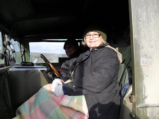
Woke up after a very cold night.  It had got down to 31 degrees Fahrenheit and it was a very cold morning.  Put the windows on the truck and layered up with clothing as it was very cold in the van.
 
Just before Beaver Creek we went through Canadian Customs so it was goodbye to Alaska and its friendly people and hello to the Yukon.
 
Our overnight stop was at Beaver Creek which has a population of 112 people.  Near this Yukon community, American soldiers encountered extensive permafrost.  When builders scraped off the insulating layer of overburden, they transformed the permafrost into an ice-bottomed mud bog.  On October 28, 1942 the 97th Engineers met the 19th Engineers here, forming a continuous link between Dawson Creek, BC and Fairbanks.
 
Beaver Creek which is home to the White River First Nation is Canada’s westernmost settlement adjacent to the Canada/US Border.  Primarily a border post and a service centre for the Alaska Highway.  In the early 1900s, the settlement of Beaver Creek was established as a camp for the team surveying the Canada-Alaska border.  Later, mining interest developed in the area and in the 1940s, the Alaska Highway was constructed.  In the mid-1950s, a Canada Customs post was built and the community of Beaver Creek began to develop.  Here the Alaska Highway parallels the majestic outer rim of Kluane National Park offering one of the continent’s healthiest grizzly populations.  We are yet to sight any sort of bear.
One of the residents has a collection of everything imaginable that can be collected so members of the convoy made a beeline to his house.  He has built a couple of out buildings, which resemble a barber shop, grocery store and bathroom.  They were deliberately built with uneven flooring so that they would look old.  Apparently you don’t need a permit to build in this neck of the woods.

Day 18 - Delta Junction


Yesterday on the way from Fairbanks to Delta Junction was our first sighting of the Alaska Pipeline. It is made in a zig-zag pattern to allow for pipe expansion or contraction due to temperature changes or movement caused by forces, such as earthquakes.  The pipeline runs 800 miles from the oil fields of Prudhoe Bay to the dock at Valdez and carries more than 2 million barrels of oil a day.  It is 48 inches in diameter and insulated with 3 3/4 inches of fibreglass.  All that is jacketed in galvanized steel and in some sections, refrigerated with a brine mixture to keep the line from melting through the permafrost.
 
Delta Junction is the official end of the Alaska Highway.  Established as a highway construction camp in 1918.  The Richardson Highway was established as a wagon road in 1920. With the coming of the Alaska Highway during WWII, a community grew up at the junction of the Richardson Highway and the new Alaska or Alcan Highway.
 
Today we rejoined the convoy group at the Deltana Fair Ground in Delta Junction for a rack & stack and lunch which was provided by the towns people. Talking to the local people is very interesting as you get an insight into the life in the freezing cold zones.  One lady said that she had 4 sources of power/heating in case one failed she had a backup with the others.  Her husband was a linesman and had worked on the pipeline and then worked for many years at Prudhoe Bay - they had spent more of their married life apart than together.
 
We were driven by a female school bus driver to the museum and official sign stating the end of the Alaska Highway for a photo shoot. The school buses are all named so that the children don't get on the wrong bus and we were on the "Duck" bus and behaved just as naughty kids do.  We were provided with free cake and icecream and went back to our van with full tummies.  Jim was interviewed by a local radio station reporter about our trip and "George" as he heard Jim's "Aussie" accent and just had to get that accent on his radio station.
 
We drove on to the Gerstle River Black Veterans Memorial Bridge which was built in 1944.  The bridge is 1 of 4 steel through truss-style bridge constructions on the Alaska Highway.  It was renamed in 1993 to commemorate the 3,695 black soldiers of the 93rd, 95th, 97th  and 388th US Army Corps of Engineers for  their contribution to constructing the highway.
 
Our night stop was at Tok which is known as the Dog Capital of Alaska as it has a heavy influx of both breeders and mushers.  When we arrived a group of Aussies were leaving the Fast Eddy’s restaurant as they were on a bus tour.  We happened to catch up with one of the guys the following morning and he lives a couple of suburbs away from us in Helena Valley, West Aust.

Tuesday, August 21, 2012

Arctic Circle pics


Pics - more


Yep, normal amount of guys around a vehicle that needs fixing.  Always good to have LOTS of input - especially for the owner!!!!

Pictures of trip


Day 17 - Delta Junction

Off again and this time to Fairbanks on our own. A very scenic drive leaving our campground and through part of the Denali National Park. This area caters for all outdoor activities hiking, white water rafting, offroad vehicles etc. Morning tea stop was at Nenana which appears to be an inland port but we shall have to do more reading up on this area as it looks as though there is an interesting history attached to this small town. While we were parked several people came up and asked us about the trip and vehicle. One bubbly lady on a motorbike came up and said she couldn't resist coming up and finding out more about our "beautiful" vehicle as it was so "neat". We asked what they do in winter time and whether they are landlocked as temperatures go very low (like -40) and she said that in actual fact everything "opens" up as the areas that they can normally not drive on as they are too boggy become iced over and they are able to take their snowmobiles etc over them. The skiers, mushies, hunters etc all take advantage of the snow covered ground. Apparently they used to take the train over the iced over lake when it was covered with about 4ft of ice. She and her husband originally came from Pennsylvania in 2004 and loved Alaska.
The drive from there to Fairbanks was easy driving, a few large hills but on paved roads. We seem to be striking road works wherever we go as they obviously have a small window in which to do their repairs. Our GPS directed us to the Walmart shop that we were seeking and after getting the necessary supplies we were on the road again to the North Pole. What a unique area this is and we discovered that YES Santa is real. His reindeers are in the yard waiting for next Xmas and we saw Santa's house which just so happened to be full of tourists shopping of course for everything that Santa and his Elves had been making during the year. Unfortunately Santa was on his 2 day leave when we were there so we didn't get to see him in person. I hope he remembers our address as I think he has forgotten it lately!
We could not find any suitable RV parks once leaving Fairbanks so we decided to head on for Delta Junction and found a lovely park on the edge of town. Apparently there is a resident moose in the woods close by but we haven't seen it yet. Some of the other convoy members are camped here as well. It is probably one of the best parks during our whole trip and the internet is reliable. We have had difficulty connecting to the internet since our trip began so we are taking advantage of it while we can.

Day 16 - Denali National Park

Had a 13 hour sleep and got out of bed at 9.00am. Jim serviced the van while I attended to the washing. In the afternoon we drove out into Denali National Park and dropped into the visitor information centre which has a very interesting display of the animals in the park etc. We watched an 18 minute movie taken of the park in all seasons. It would be lovely to see in winter but we are not so sure we could handle the cold. The leaves on the trees are just starting to turn golden and in a couple of weeks it would look stunning with all the autumn colours. We have decided that we shall leave the convoy group for a couple of days and go further north to Fairbanks and the North Pole since we are so close. We will rejoin the group at Delta Junction on Tuesday. A few others have decided to go on to Fairbanks also. At present we are sitting in the cab of the van updating our diaries as it is quite warm in here. Jim has a convoy meeting at 8.00pm so we have to stay awake until then!!!

Day 15 - Willow

Awoke to discover that the camp owner had supplied cinnamon buns and coffee for breakfast. We had already eaten our muesli so saved the buns for morning tea - they were yummy. We are enjoying driving on sealed roads again although the traffic is starting to get busier. Our morning stop was at the Alaska Veterans Memorial Park dedicated to the veterans of Alaska who have served their country at home and throughout the world. The main part of the site consists of five 20ft tall concrete panels, one each to represent the Army, Air Force, Navy, Marines and Coast Guard, arranged in a semi-circle in a natural grove of trees. On each panel is a short history of that branch's contribution to Alaska. A lovely setting looking towards the highest mountain (Mt McKinley) which unfortunately was not visible to us because of the fog. Nevertheless we all gathered for a group photo with the "invisible" mountain in the background.
We then drove on to our campgrounds in the Denali National Park. Our campsite is on the edge of a hill with views to some very picturesque mountains. An early night as we were both very tired and this is a 2 night stop.

Day 14 - Palmer

A very beautiful drive from Glenallen to Palmer. We had the windows on in the morning as it was quite cold and raining. We stopped at a place called Sheep Mountain where the owners invited us to stop and have morning tea. Lovely home made cookies, tea and coffee. We are a big crowd to cater for and it takes special people to put their hands up and invite such a big group for morning tea. It is a lovely resort in the mountains with views to the mountains. They have sled dogs which they are training for the winter season. The resort is popular in summer and winter although restaurant services stop mid-September but the cottages are self contained.
We parked by an airstrip and had to walk through the neighbours property to get to our morning tea stop. Well the neighbour's yard was a graveyard for old Volvos - apparently he gets the vehicles that are written off by the insurance company. The boys had the cameras flashing as amongst his collection were a couple of ex-military vehicles.
Just after we left the morning tea stop we passed a huge Glacier. Unfortunately we had the windows on the vehicle so this prohibited some good photo shots.
From Palmer some of the group went on the unsealed road through Hatcher Pass and others, including us, went by the sealed road route and stopped off at the Transport Museum. A very good collection of all sorts of vehicles, trains, planes and memorabilia.
That night we camped at Willow and had a meal of burgers and sausages cooked by the campground owners. We discovered that we were parked right beside the trainline where it crosses the road . The train runs between Anchorage and Fairbanks and at some unearthly hour in the morning we thought the train was coming through our "house".

Day 13 - Glenallen

Part drive on unpaved road and then we hit the bitumen. It felt really, really good!! Stopped at Tok for morning tea and then drove on to Glenallen which has a population of 454. It is known for its outstanding scenery, great fishing and friendly people. Glenallen is the centre of the Copper River Basin, one of Alaska's premier outdoor recreation areas. It is bordered by four mountain ranges that include Wrangell St Elias National Park, the largest National Park in the United States and dozens of beautiful rivers.
Though Denali National Park contains the highest peak in North America, Wrangell-St Elias boasts nine out of the highest 16 peaks in the US as it serves as the crossroads of three great ranges, Wrangells in the north, Chugach Mountains in the south and the St. Elias Mountains arching up from the Gulf of Alaska.
The RV park owner arranged a dinner of salmon and beef for us that night and the Commissioner of Transport was there to formally greet and welcome us. The young First Nation children entertained us by dancing and singing. A very interesting and enjoyable evening. Although there was a cold wind blowing and we were all trying to keep warm. Some of the locals were easy to pick out as they were walking around in T-shirts and no jumpers.

Day 12 - Top of the World Highway - Chicken

Off again at 7,00am as we were driving on Top of the World Highway. What a magnificent view from the winding ridge-top road. We are amazed at the amount of mountains they seem to go for as far as the eye can see. A very mountainous drive once again putting the vehicles to the test. When we reached the Canada/US border we had to go into the office and fill out paperwork as it was our first point of entry into Alaska. Even though I had completed the forms online they only applied if we had arrived in the US by air. We were fingerprinted and photographed and crossed into Alaska USA. We all assembled a little distance away from the border crossing waiting for all members of the convoy to clear through Customs. One jeep towing a trailer had rolled that morning but fortunately noone was hurt. The next day the maintenance team worked hard and the vehicle was once again on the road.
We then drove over a long unsealed road through more mountains and valleys to our stop at Chicken which has a population of 21. This little place is in the middle of nowhere but a stopover for people wishing to go on the Top of the World Highway. Everything is designed around a chicken theme,
The town got its name when gold seekers settled there in the late 1800s and owed their very lives to the ubiquitous ptarmigan they ate to survive.
When the town was incorporated in 1902, locals wanted to name it in honour of this crucial bird, but no one knew how to spell it. Fearing ridicule if they got it wrong, they settled on Chicken instead. A number of historic buildings remain, and visitors can enjoy fishing, a scenic kayak on the Fortymile River or gold panning, just like the original prospectors.
A few tried their hand at gold panning but we haven’t heard whether anyone struck it rich.
That night we had a chicken dinner and socialised with the convoy group as it was a lovely warm night outside and still daylight. Later a Kiwi couple came up to our campsite as they had heard that there were some Aussies on the trip. Once we had been talking for awhile they discovered that they knew one of the Kiwis in our group but unfortunately he was camping at a different RV park and they didn’t catch up with him. It really is a small world!!
We also met an Australian guy called "Frosty" who was riding his bicycle around parts of North America. A group of about 14 had come over from Australia to do various treks and some had already gone home. He was riding alone when we caught up with him. He needs a medal for the mountains and road conditions that he is riding on and the distance he is managing to cover each day.

Day 11 - Dawson City

We drove about 12kms out of town and had a tour over No. 4 Dredge which was in operation until 1959. It had been covered by mud and debris in 1959 when the dam higher up the river broke and flooded the lower reaches. The dredge is the biggest wooden hull, bucket-line gold dredge in North America. It rests on Claim No. 17 on Bonanza Creek. It is being restored and maintained by Parks Canada. The wood is Douglas Fir and is very, very expensive to buy and hard to procure.
The rest of the day was spent looking through the information bureau and shops for books and generally wandering around. Everyone is so friendly in this small town and obviously our arrival was well publicised before we came. One chap who came up and spoke to us had driven over 100 kms to come to town to get a haircut and hopefully see some of the military vehicles. A pretty expensive haircut!!
The only access to the Top of the Road Highway that we were going to be driving on was to cross the river by ferry boat so at about 4.00pm we queued for about an hour until it was our time to board the ferry. We camped at a National campground right on the edge of the river set in amongst the bushes. It was bear country so "bear precautions" had to be observed.
On the river's edge about a 1/4 mile up from our campsite there were about 5 wrecked

Day 10 - Dawson City

Called in at Fischers roadhouse for refuelling on the way to Dawson City. The lady in the roadhouse had spent many hours the day before baking cinnamon buns and other cakes for a complimentary morning tea. It was very much appreciated and they were very tasty. The workshop was a hive of activity with some from the convoy members repairing tyres and whatever else was damaged by the unsealed roads. Jim gave George a pressure clean to get the majority of the mud off.
The discovery of gold in the Klondike valley in 1896 led to the establishment of a tiny community where the Klondike River flows into the Yukon. By the summer of 1898, Dawson City was the largest city in Canada west of Winnipeg, with a population of 40,000 in the immediate area. Within months, Dawson boasted telephones, running water, steam heat, steamboat services and a wide range of elaborate hotels, theatres and dance halls.
A year later the gold rush was over and 8,000 people left town in a single summer. By 1902 Dawson City’s population had dropped to 5,000 declining further in the early part of the 20th century. In the early 1960s Dawson City was declared a National Historic Site. Preservation of buildings and historic areas, an assortment of activities related to the Klondike Gold Rush and other tourism initiatives draw some 60,000 visitors each year.
The city looks like something out of a cowboy movie and now has a population of 1,800. It is home to a casino, restored cabins and boardwalks and the roads are unsealed.
This was a 2 night stop at Dawson City and a chance to catch up on some vehicle maintenance, van cleaning and washing. We still have more gravel roads ahead of us so it is pointless spending too much time on the dust issue.

Day 9 - Arctic Circle

A very cold morning as we headed off to the Arctic Circle. A drive along the top of the mountains made you feel that you were driving on top of the World. Finally arrived at the Arctic Circle where an individual vehicle and group photo were taken. It was a special occasion and the furtherest point north that either of us has been. Very cold with a little rain so we had many layers of clothes on plus our faithful beanies. The ground once again was permafrost and hard to walk on. One of the ladies picked some huckleberries - tiny little berries which we have never seen before but I guess a food source for the wildlife. We had to return over the same road to continue our journey to Dawson City. Road seemed to be a lot rougher coming back and there was more traffic. That night we camped in the Tombstone Territorial Park - apparently bear country but we are yet to see one.
We were very tired after a long day of driving and were in bed by 8.30pm. Lots of sunlight hours with sun setting around midnight and rising about 4.00am - it has always been light when we get up at 5.00am.

Day 8 - Eagle Plains

A cold morning start from Klondike River Lodge to Eagle Plains.
A very scenic drive along an unformed road with a few potholes. After a drive through pine and spruce trees the landscape opened up into the Tundra where there was not a lot of growth. Underneath is the permafrost and it is very springy to walk on. The drive through the Tombstone Territorial Park was absolutely stunning and would have to be one of the highlights so far. The huge rugged mountains of all different colours and sizes. Some very stoney and look like they were built with large oblong blocks of stone and others more of the shale type. Lots of rivers and creeks at the base of the mountains. The drive up to Eagle Plains was up and down mountains and more mountains etc (most in 2nd gear) with no side rails and a very steep drop to the side. The 360 degree view from the lookout at the highest peak was well worth the effort.
Passed a couple of gas/oil drills on the high ground.
We spent the night at the Eagle Plains Hotel & RV Park and had a nice roast beef/chicken buffet. This resort caters for the road workers and tourists but there are few tourists in winter.
This would be a very cold spot as it is located on the top of the hill and would get the wind no matter what direction it came from.
Animal for the day - 1 rabbit & 1 bird

Friday, August 10, 2012

Day 7 - Klondike River Lodge

A shorter drive today from Pelly Crossing to Klondike River Lodge. Rugged up this morning and drove in heavy mist for quite some way. The mist cleared and we drove up a high hill which opened up to the most spectacular view revealing more mountain ranges in the distance.
No wildlife on this stretch of road except 1 crow.
We are camped in the grounds of the lodge and have access to all facilities including wifi, but the latter is soooooooo slow!  It is light and it seems strange to go to bed when the sun has not set.

Day 6 - Ross River to Pelly Crossing

Left Ross River to Pelly Crossing all rugged up in our wet weather gear. The road ran beside the lake with mountains on the other side.

When we arrived at the turn off to Fargo one of the local ladies had baked muffins for everybody on the trek. Each convoy stopped in turn to get a freshly baked muffin - the local hospitality was very much appreciated and this lady must have been baking for hours to cater for us all.
Lots of rain today and photos could only be taken through the open side windows. No dust but plenty of mud. The scenery was still spectacular and there were some beautiful mountain passes and rivers.
We drove past Eagle Rock on the Yukon River which was the site of the worst accident in the history of the territory's riverboat travel. In September 1906 the sternwheeler Columbian exploded and burned, killing 5 men. The steamer was carrying a crew of 25 men and a full cargo, including cattle and 3 tons of blasting powder destined for the Tantalus Butte Coal Mine, 30 miles down river
We crossed over one of the four bridges over the Yukon River and arrived at Carmacks. The area around Carmacks has abundant mineral resources, including coal, copper and gold. We were welcomed by the locals who had cooked hamburgers and sausages for our lunch. The hospitality of the local people is amazing and nothing is too much trouble. We are a huge group to cater for and arrive at different times. The area where we ate was surroundered by wooden 1/2 walls and nets and apparently in winter they pour water into this area and it freezes and becomes their ice rink. Ice hockey is a favourite sport in Canada. With or without ice we were quite cold by the time we left the luncheon and drove in the truck with blankets over our legs for the remainder of the day.
From Carmacks we travelled on to Pelly Crossing, the home of the Selkirk First Nation, where we refuelled and camped in the grounds of the Community Centre. The Selkirk First Nation community was established as a ferry crossing and a highway construction camp when the Klondike Highway from Whitehorse to Dawson City was built in 1950. With the completion of the Pelly River bridge and the road to Dawson City, sternwheeler traffic on the Yukon River came to a halt. Fort Selkirk, located near the confluence of Pelly and Yukon Rivers, was virtuallay abandoned. The Selkirk First Nation moved from Fort Selkirk to Minto Landing before settling at Pelly Crossing which has a population of approximately 300.

Day 5

We had plenty of thunder and it had rained slightly over night - the first bit of rain since our trek began.
An early departure from Watson Lake on the Robert Campbell Highway headed towards Ross River. After about 50kms the bitumen was behind us and we were driving on a gravel or "washboard" road as they call them over here. We had to be escorted by a pilot vehicle through about 10km of roadworks. The road was rough and dusty with a lot of loose stone and plenty of grades, some required 2nd gear to be used. The dust hung on the road as there was no wind to blow it away so we had to increase the distance between vehicles. It started to rain which helped keep the dust down but covered the vehicles with mud. George will need a really good clean before we ship him back.
The countryside is made up of mainly spruce trees and small pines and there are lots of lakes and rivers.
We camped in the Ross River Secondary School grounds and had access to their bathroom and kitchen facilities. It was very welcome after a long day of driving. Some of the guys slept in the gymnasium so they didn't have to put up a tent that night.
The settlement at Ross River grew with the building of the Canol pipeline service road in WWII. Completion of the Robert Campbell Highway in 1968, linked Ross River to the rest of the territory by road. Today, Ross River is a supply and communication base for prospectors testing and mining mineral bodies and home of the First Nation, The Ross River Dena Council. Originally, First Nations people used the site as a seasonal camp and gathering place. In the early 1900s, prospecting and mining increased in the area, and a trading post was established nearby in 1903. Today approximately 335 people live in Ross River - most are members of the Dena Council.
A member of the local community came and saw us as his deceased grandfather had owned a Chev CMP. He is now the proud owner of that truck and was asked to restore it and put it in the museum but he prefers the vehicle the way it is as it tells a story with all its bumps and scratches. He said he would go home and take photos of the vehicle and put it on a DVD for us. When we awoke the next morning the DVD was in the cab so he must have returned after we had gone to bed. We look forward to viewing it when we have a moment and are hoping that he has left an address so that we can contact him.

Tuesday, August 7, 2012

Day 4 - Watson Lake Yukon

Tuesday 7 August

Went to be early last night and slept in this morning. It felt great!! Had to put an extra blanket on the bed early this morning as it got quite chilly.
Jim went to the other RV park which is the only place where the trekkers can undertake maintenance on their vehicles. They are very environmentally conscious.on this trek. Being a large group we are often spread over a few RV parks in the towns. While Jim did the maintenance and shopping I attended to the washing etc. He put up a tarp for me while he was gone which was fortunate as we had a few spits of rain. I managed to send an email or two but the wifi reception is not very good and is so slow.
Later in the afternoon we went out to the BC - Yukon Air Service Ltd Hangar which was a military hangar constructed when the American Army needed better facilities on the northwest staging route. Allied Russian pilots collected the planes in Alaska and flew them over Siberia to their own front lines. BC-Yukon Air Service Hangar is the last military hangar of its type in the Yukon. Built in 1942 as one of the NW staging air strips.
As I write this blog it is starting to thunder and black clouds are rolling in. 

Tomorrow we head off on the Campbell Highway so it is early to bed and early to rise.

Day 3 - Arriving in the Yukon

Monday 6 August 2012
Woke up to a beautiful view over the lake and the moose were still in the water. Left at 6.15am and drove from our caravan park to the Poplars RV Park where we were to meet the other trekkers.
Steep winding grades again and then the road narrowed and wound around Muncho Lake. We had mountains to our right and the lake close by on our left. The lake was used as a refueling stop during the construction of the Alaska Highway. The road around the lake was a challenge and the workers had to cut through the lake's rocky banks and use horse-pulled stone boats to haul rock away. Today it is a popular tourist destination.
The Alaska Highway runs parallel to the Liard River north to Watson Lake so there were glimpses of the river through the trees. The river gave the engineers a natural line to follow during the construction of the highway. The Liard River Bridge which was built in 1943 is the only remaining suspension bridge on the highway.
Our morning tea break was at Liard River Hot Springs. This was the site of a major construction camp. The natural hot springs were used by the troops daily, and once a week they left, leaving the hot springs to the women in the camp.
The lunch stop was at Allen's Lookout where legend has it that a band of outlaws took advantage of this sweeping view of the Liard River to attack and rob riverboats. A small stone marker with a hand stamped plaque near the picnic area is dedicated to the Army Engineer surveyors of the Alaska Highway.
We then drove through Contact Creek where on September 24, 1942 soldiers of the 36th Regiment from the south and 340th Regiment from the north met, completing the southern section of the highway. The highway crosses the British Columbia and Yukon border seven times between Contact Creek and Mile 627, but Mile 627 marks the official border crossing.
We crossed many mountains again today which put the old vehicles to the test again, but the views were magnificent. We saw 4 stone sheep, lots of bison and wild horses along the road.
We arrived in Watson Lake mid afternoon and after a brief drivers' meeting headed to our respective RV parks where we are spending 2 nights. We are in the Signpost RV Park close to the World famous signpost forrest which is Watson Lake's best known attraction. The forrest was started in 1942 by a homesick US Army GI (Carl Lindley) who was working on the Alaska Highway. He erected a sign pointing the way and mileage to his hometown in Danville Illinois . This started a trend and others have followed suit and in July 1990 the 10,000th sign was erected. Carl Lindley and his wife visited the site in 1992, 50 years after his first post was errected.
One couple in the park had just arrived in Watson Lake from Alaska and said it was the only warm day they have had since leaving their home in Missippi in May. They have struck cold and wet weather along the way.  We have been lucky so far!!!!
Watson Lake is known as the Gateway to the Yukon.

Day 2

Sunday 5 August 2012


Up to find that there had been a heavy dew overnight and the grass in the fields was quite damp. We slept well even though we were camped a short distance from the highway.
The assembly and departure of all the vehicles went like a charm this morning as everyone now knows the procedure.
A long drive in the morning with pine trees lining the road. There were sections of pine trees that were affected by a beetle and the trees have died. One of our convoy members is an ex-forrester and said that the beetle lays eggs in the trees and they then eat around the trees in a circular pattern effectively ring barking the trees. They mill the trees but the dust is quite dangerous and has exploded and caused death and injuries, now more precautions are taken.
Our morning tea stop was at the Prophet River Air Strip. All our stops have to be big enough to allow for the whole convoy to park together.
A mountainous drive into Fort Nelson where we stopped for lunch and refueled. Fort Nelson has a population of 5,055. It was home to approx 2,000 troops during the construction of the highway. The town has been rebuilt about 5 times due to fire and finding better locations.This is a base for the gas industry which is quite substantional. We will be staying at this town on our way back so will have a better chance to have a look around.
As it was Sunday there was no problem parking and there were not many people around. A pick-up sack lunch was supplied by the community and Elks Cub and consisted of a sandwich, cookies, piece of fruit and drink.
The afternoon presented us with some amazing scenery through mountains and valleys of the Rocky Mountain group. There were huge and long grades to climb and the old vehicles were put to the test. Once again the concern was that they might overheat. We drove up and along the ridge of Steamboat Mountain (named because of its resemblence to a steamship) with views over the Muskwa River Valley and Rocky Mountains to the southwest.
Summit Pass at 4,250ft is the highest summit on the Alaskan Highway. At Mile 397 crews had to blast through the rock to create a road. It is a beautiful area of bare, rocky peaks.
Our camp for the night was at Toad River Lodge. This is an historic lodge which has been on the highway since 1950. On the ceilings is a huge collection of hats which number more than 6,800.
We were lucky enough to have a site along the edge of the lake and saw 2 moose in the water on the other side.

Day 1 of trek

Saturday 4 August 2012

This was the official start of our trek.
The alarm was set at 5.00am and we were surprised to find that it was already light.
Our convoy group consists of 2 x blitz's, 2 x GMC's and 6 x Yankee Joes. There was a 5 minute gap between each convoy group leaving the departure point and the convoy must have stretched for miles. There are 10 groups including pathfinders.
We drove along the Alaska Highway for approx 34 kms and then diverted onto the old original Alcan Highway (now known as the Alaska Highway) and crossed the Kiskatinaw River Bridge. The bridge is a 531 feet long curved structure and one of the first of its kind in Canada. It is the only original timber bridge built along the Alaska Highway that still is in use today. We drove for several miles until it joined up with the Alaska Highway again.
The drive through the Peace River area was amazing with the beautiful mountains and valleys.
The Peace River Bridge is 712 metres long with a metal mesh deck. Bridging this river was one of the first goals of the Alaska Highway engineers in 1942. The original bridge collapsed in 1947 due to erosion and the bridge was rebuilt in 1960.
Our morning tea stop was just over the bridge at Taylor which has a population of approx 1200. This was the first main army camp for the 341st engineers. Before the Peace River was bridged in 1943 the ferry from Taylor served as the major link across the river. The original Peace River suspension bridge, the longest bridge on the highway, collapsed in 1957.
One of the GMC's had trouble getting to the convoy speed of 35mph because he was towing a trailer fitted with a camper. After the lunch stop his support vehicle towed his trailer.
We then drove on through Fort St John and were surprised at the large light industrial area. It is obviously the centre for supplying trucks, equipment etc for the gas and other industries in the area. We had been told that we would come across a lot of trucks carrying gas.
One of the most treacherous hills on the original highway is Suicide Hill which is noted for its ominous greeting "Prepare to meet thy Maker". The trucks are very slow going up the hills and the concern is that they may overheat.
We saw an eagle, 1 dead moose and smelt a few others. It is a case of suffer and don't breathe for awhile when you are driving in a windowless truck!!!
We spent the night camped in the fields at the Buckinghorse River Lodge. The restaurant is the original US army dining building from 1941. Dinner was roast pork, vegies, salad, icecream and iced tea. After a chat amongst our convoy members it was early to bed.

More photos of official launching


Photos at launching ceremony


Official launch

Friday 3 August 2012
All the vehicles assembled in Dawson Creek (Mile 0) for the official launching ceremony. A lot of people circulated around to view the vehicles and talk to the owners - even the women come up and ask questions.
After the ceremony we went back to the camp ground to be treated with a BBQ of hamburgers and sausages supplied by Trimac, a local transport company. There is a shortage of drivers because of the gas and coal industry and they are desperately trying to recruit drivers.
We did the majority of our packing as we were due to form into our convoy group at 6.30am the following morning.

Thursday, August 2, 2012

More vehicles


Some of the participants have 1st class accommodation when they travel.  They have their RV going along as well.

Camp Sewell - bottom picture

MVPA convoy vehicles

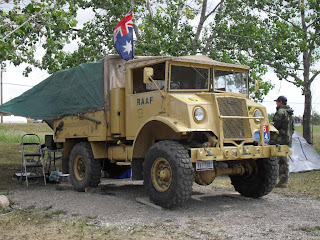
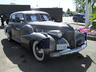
These are some of the vehicles that will  be travelling from Dawson Creek to Fairbanks.  The bottom picture is of a Blitz that went on the 2009 Normandy convoy with us.


Dawson Creek - Mile 0 Alaska Highway

The start of the Alaska Highway

Canadian convoy

These were some of the vehicles that were on the Canadian convoy that we travelled with from Chilliwack to Dawson Creek. 


Dawson Creek & Rolla

1 August 2012


A busy day in the camp cleaning out and repacking George, washing and general maintenance on the truck. Registrations began in the morning and there was a queue up until closure at lunchtime. Massive amounts of time and energy have gone into the organisation of this convoy.
We received our convoy shirts and goodies and now have name tags so that we know who everyone is or maybe it is so we can remember who we are.  We are a very big group!
There seems to be a continual flow of onlookers driving through the park and stopping to ask participants about their vehicles. Everyone seems to have had a grandfather or relative who worked on the construction of the Alaska Highway and they are very pleased to see the 70th anniversary commemorated. .
So far there are just 2 Blitz trucks in the convoy and there is a Yankee Joe parked next door to us. There are some big military rigs with lots of gear as well - the camera has been clicking continuously. Vehicles are arriving all the time from various parts of Canada and the US and some have travelled great distances to get to Dawson Creek.
In the afternoon we formed a convoy to drive to a little town 12 miles out of Dawson Creek called Rolla which is celebrating its 100th anniversary. The convoy was very long and impressive and that wasn't all the vehicles. Jim had me sticking my head up out of the top hatch taking photos but unfortunately the battery died on the camera. Hopefully we will have managed a couple of good shots, if not I am sure there will be others floating around.
This is a cereal growing area and the crops were thick and green.
We were provided with a burger or sausage in a bun and drinks for dinner and were thoroughly spoilt. I bet the poor cook could see no end to the line. Later we were entertained by a ladies choir. There was a quaint log cabin in the grounds surroundered by statues of a bear, deer and moose. It was a lovely setting and an enjoyable day.
Since being on the track we have passed an enormous amount of timber and coal trucks - both big industries up here.